
Ultimate Day Trip to the Interior’s Hidden Gem in Merritt, British Columbia
Words & Photos by Sam Egan

When it comes to day trips within the province of British Columbia, for many of us it doesn’t get much more central than Merritt. Toted as the informal gateway to the Interior, it’s located at the confluence of both two major rivers and a number of major highway arteries, making it relatively easy to reach from wherever you’re hailing from. Although the main riding areas aren’t far off the highway, this small town is rich in history and the western-styled downtown offers big views of the surrounding hills and anything you might need for your day on the trails.

Visit the local Breathe bike shop to stock up on tubes or whatever else you might need to be self-sufficient for the day. While you’re downtown, drop into Brambles Bakery & Café for a healthy and homemade pre-ride snack, meal, or something to pack along. Pack ample rubber, water and calories, as the terrain can get rocky and the riding at Coutlee Plateau somewhat remote at times.
Once you’re fully stocked, punch in the coordinates for the Coutlee Plateau trailhead parking lot, a roughly 10 minute drive out of downtown Merritt on the well-graded, 2WD accessed Midday Valley Road.

Get your bearings with the trailhead map and check out the Cow Trail Classic loop on Trailforks to get an overall sense of where you’ll be going. It’s a big loop that covers the perimeter of the Coutlee Plateau trail network, and clocked in at 17.7km round trip for us.

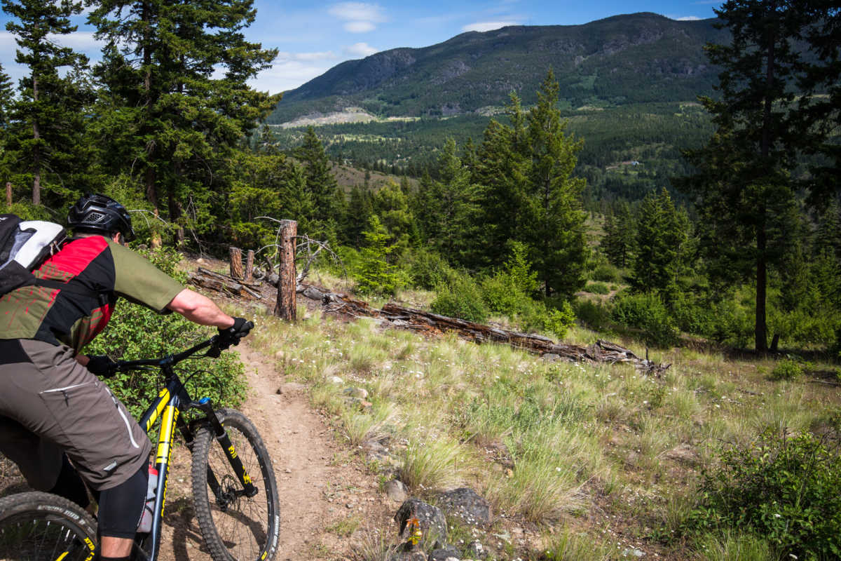
From the parking lot you’ll be more-or-less climbing a steady incline for the first half of your ride. The climb is generally very forgiving, though it may seem impossibly long at times, just keep pushing on. The descent is worth every second of uphill effort and once you reach a certain elevation, an assortment of wildflowers littering the trailside will carry your spirits to the top.

If your ascending journey makes you feel a bit over-gunned at the helm of your trail or enduro rig, worry not. Once you crest into the black Rock & Roll you’ll be glad to let the suspension soak up the impact on some of the more imposing, but optional natural features that definitely push this into “black diamond” territory. Or if you want to keep the ride blue just skip the turnoff from Notch to Rock & Roll, which circles back not far below.

Once clear of the rocky notch up top, the trail’s character changes markedly and for the roughly 4km descent down Ziggy and JP Cool, count one of the finest and most enjoyable stretches of rolling single track you’ll find anywhere. No brakes, no pedal strokes, just low grade downhill ribbons of trail, sweeping through a vibrant mixed forest; up and down banks, past ponds and along babbling brooks. The odd tight trees and loose corners will keep your speed honest and your bar length in check, but this stretch truly epitomizes the flowing single track Interior BC is famous for. Wheelies galore!
Out of the woods and back down to the meadows, you’ll be treated to commanding views of Iron Mountain across the valley, and the side-hill traverse back to the trailhead will give you plenty of time to bask in the descent.
Back at the parking lot load up the bikes and head to the old Merritt Visitor Info Centre near the junction to the Okanagan Connector (Hwy 5A/97C) – The Visitor Centre is no longer open, but it serves as the trailhead for the Iron Mountain trail network.

If you’re getting a bit hungry after that big XC loop, a quick detour into town to refuel may be in order before you tackle the next ride (climb). Do yourself a favour and check out the Kekuli Cafe for snacks and meals featuring their scrumptious bannock. Their homemade bannock is ready to snack on and relatively safe to pack up for the next leg of the journey. Too Much Info into Lone Pine is the dedicated climbing route from the base of Iron Mountain and will take you roughly 4km up to the technical black Godey, or you can bail out of the climb along the way for blue options like Deer Hunter or Ursa Major.

Alternatively, if you’ve had enough of pedalling for the day and want to check out the gnarlier DH goods from the top of Iron Mountain, make arrangements to shuttle up the Iron Mountain Service Road (take the Comstock exit off Hwy 5 about 6km south of town) and sample goods like 98 or Treats, to turn it up a notch and test your mettle. All trails on Iron Mountain will bring you back to the old visitor info centre and then you’re right on the highway, ready to make a run for home to rest those weary legs.